Overview › Maps
Maps of the affected area
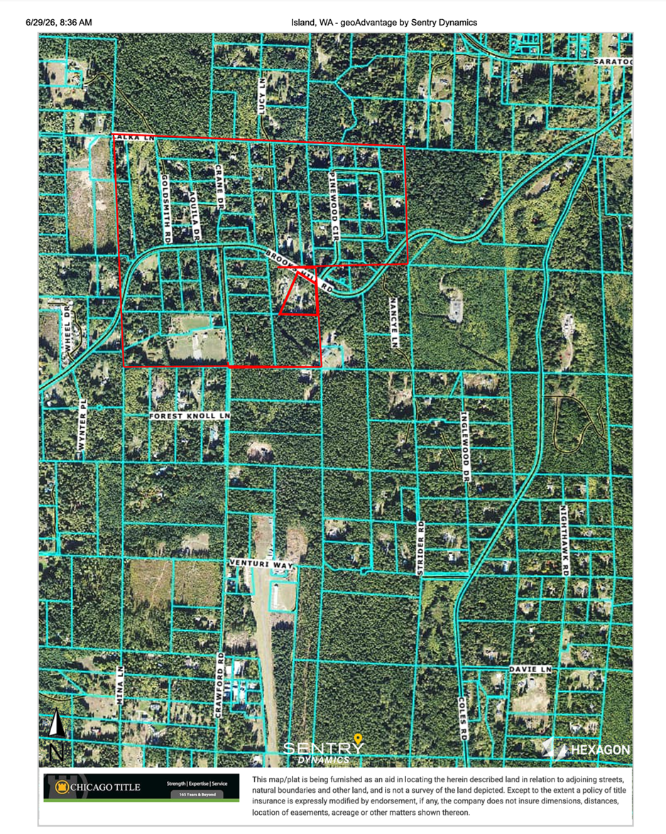
The affected cluster centers on Katya Lane in Sections 4 & 5, Township 29 North, Range 3 East. The maps below were produced by georeferencing the neighbor-provided outline against the Island County GIS parcel layer and OpenStreetMap roads.
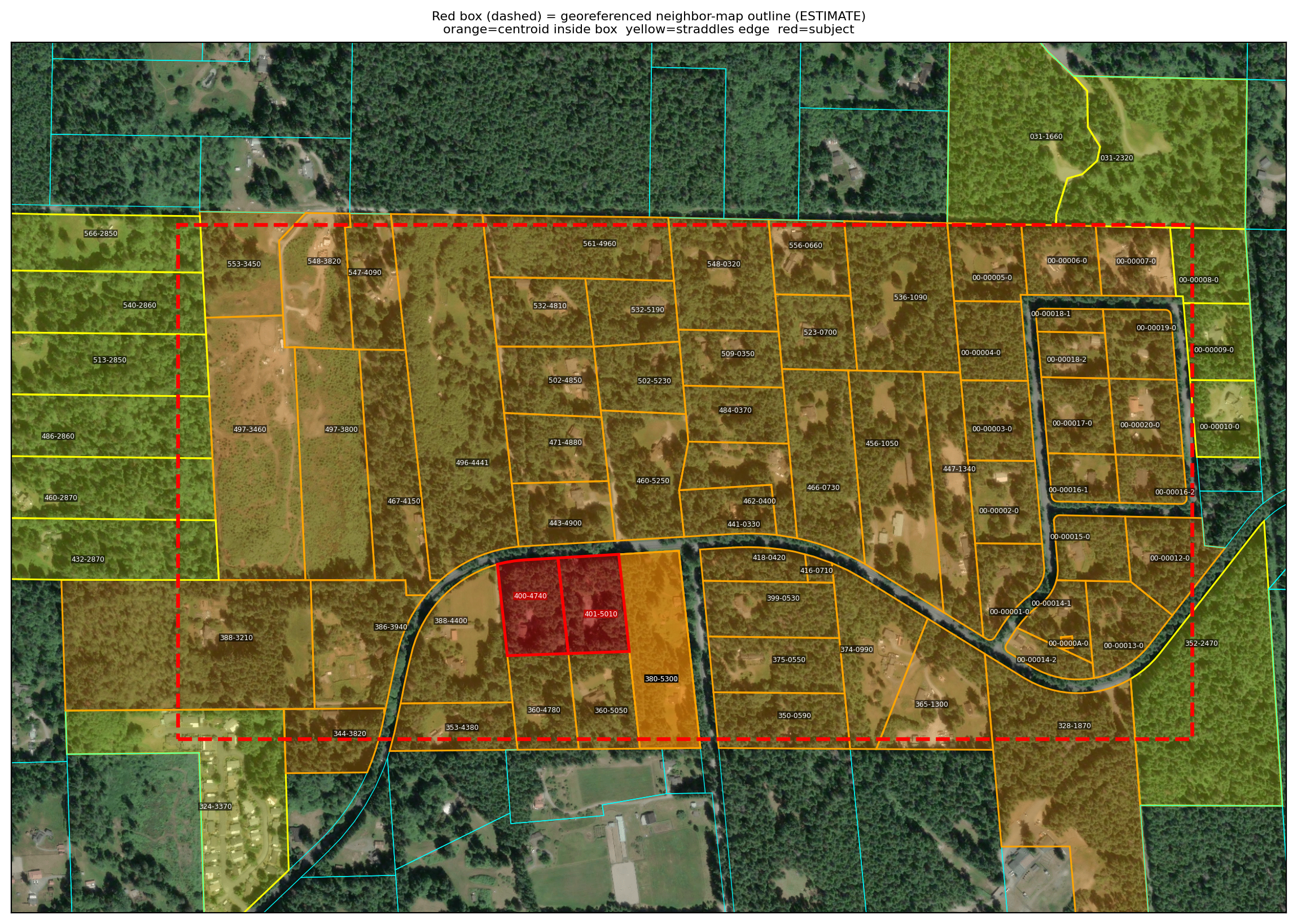
Parcel classification is a mapping estimate. The authoritative determination of
which parcels the fraudulent legal descriptions touch comes from the title company’s plat
examiner or a licensed surveyor.